Introduction
Location Map
Base Maps
Database Schema
Conventions
GIS Analyses
Glossary
Flowchart
GIS Concepts
Results
Conclusions
References
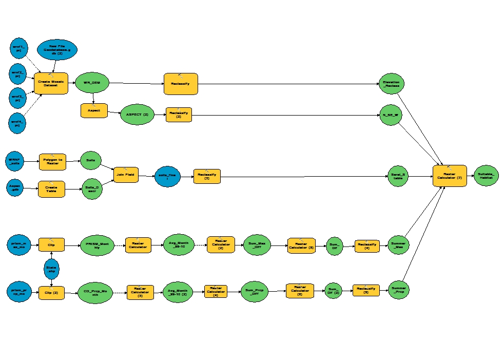
Flowchart Used in Model Design
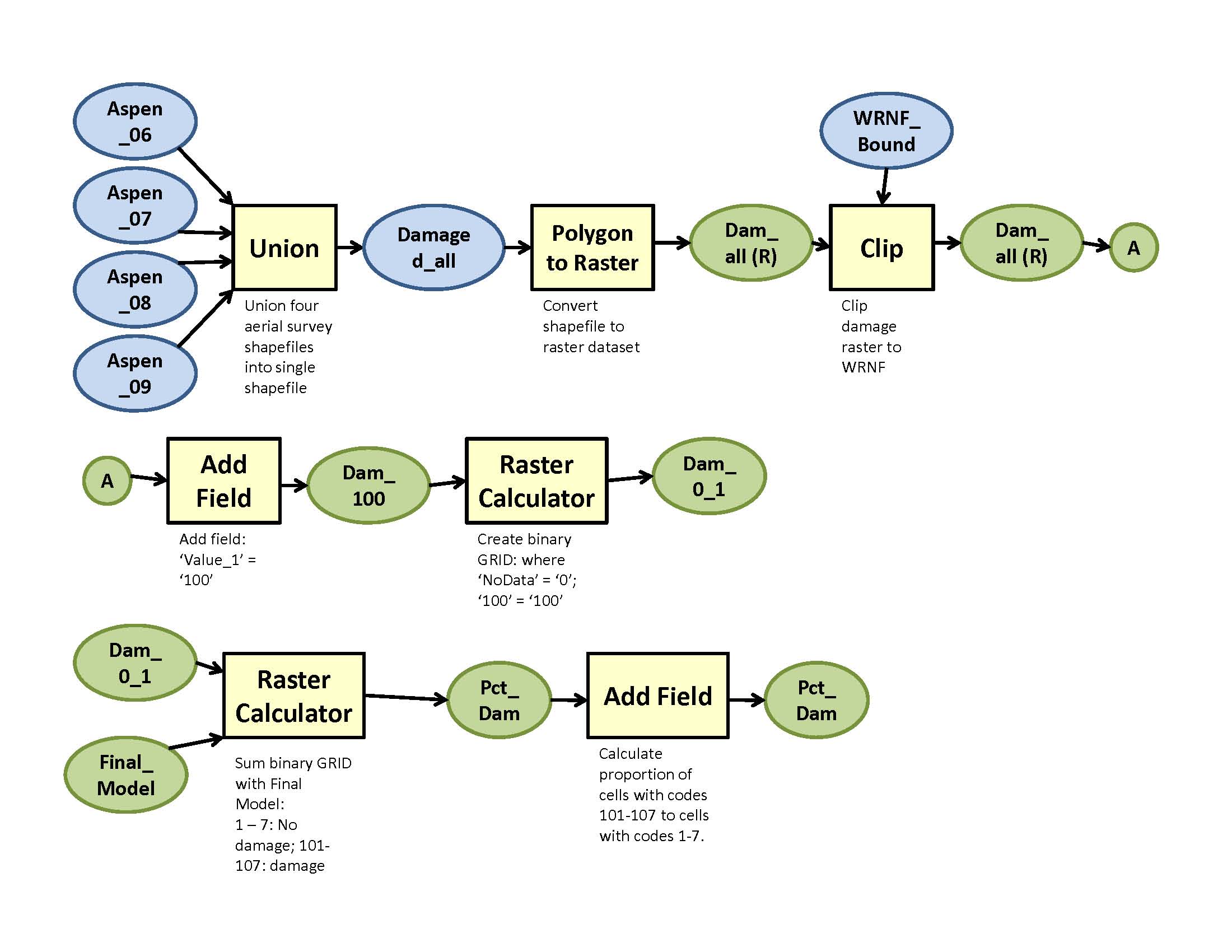
Flowchart Used in Model Testing Against Aerial Survey Data
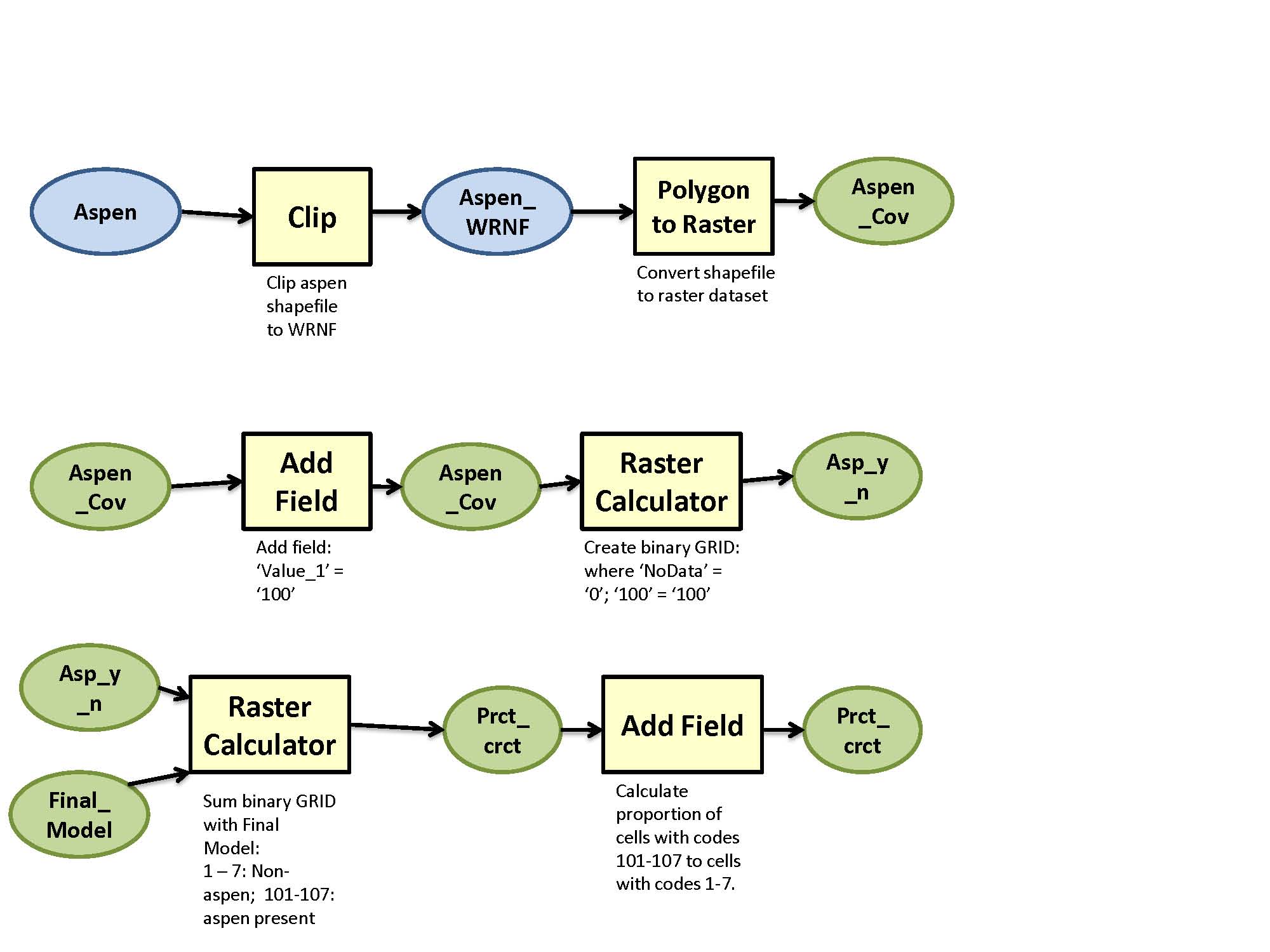
Flowchart Used in Model Testing Against
Remotely-Sensed Vegetation Data