Introduction
Location Map
GIS Concepts
Conventions
Database Schema
GIS Analysis
Flowchart
Custom GIS
Analyses
PHP Code
Base Map
Results: John
Martin SWA
Results: Lower
Gunnison
Conclusion
References
Analysis Results
We performed analysis on two separate areas, the John Martin State
Wildlife Area and the Lower Gunnison River between Grand Junction and
Delta.
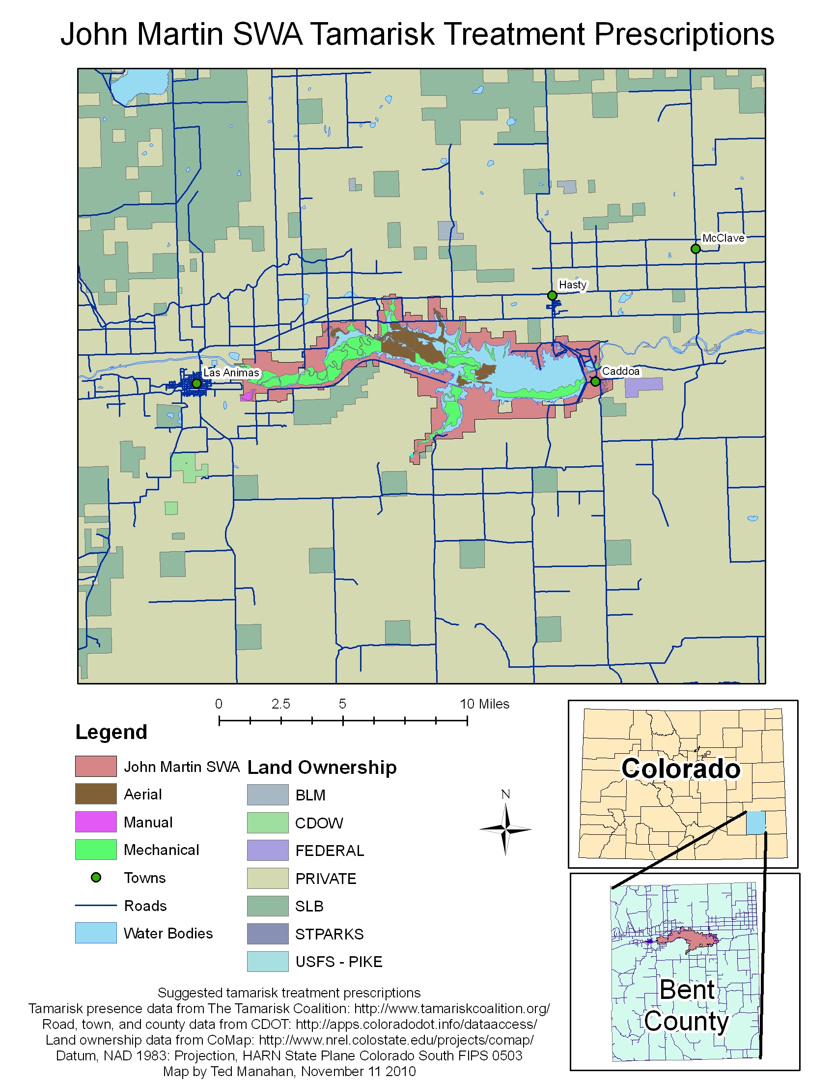
John Martin State Wildlife Area
The John Martin SWA is located around the John Martin Reservoir in Bent County. The land is mostly flat, with fairly good access. Much of the tamarisk has high density, making Aerial treatment possible for some areas. Here is a winter photo of the area showing some tamarisk in the foreground and in the water in the background: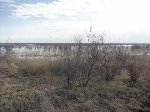
Photo from Google Earth, taken by user 1krispy1.
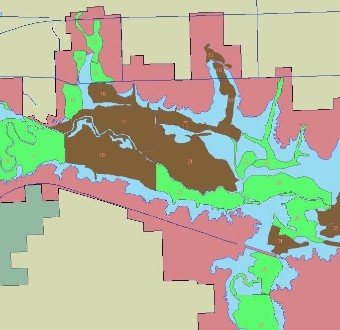
The final prescription map is shown below. A more detailed view of the map can be seen by clicking here.
The final proposed treatment groups are composed of these polygons:
Group 0: Aerial: 17 16 21 20 19 17 16 9 12 17 16 21 20 19 17 16
Group 1: Aerial: 18 17 16
Group 2: Aerial: 31
Group 3: Aerial: 32 33 31
Group 4: Mechanical: 3 37 34 35 36 22 24 25 26
Group 5: Mechanical: 4 7 10 13 14 15 5 8 11
Group 6: Mechanical: 6
Group 7: Mechanical: 23
Group 8: Mechanical: 27 28 29 30
Group 9: Manual: 0
Group 10: Manual: 1
Group 11: Manual: 2
The program used 8 trial groupings to find this solution.
The program calculates the total treatment cost by multiplying the treatment area for each polygon by the treatment cost for the selected treatment. The unadjusted treatment cost is $11,676,764. Multiplying by the remoteness index for each polygon gives a scaled treatment cost of $11,893,358. Because the treatment area is very accessible, the adjusted treatment cost is not much more than the unadjusted treatment cost. The area assigned to each treatment type is shown below:
| Treatment
Type |
Total Area |
| Aerial |
2008 Acres |
| Mechanical |
4608 Acres |
| Manual |
142 Acres |
A detailed look at the center of the treatment area is shown below, with the polygon numbers included.