
Introduction
Location Map
GIS Concepts
Conventions
Database Schema
GIS Analysis Flowchart
Custom GIS Analyses
PHP Code
Base Map
Results: John Martin SWA
Results: Lower Gunnison
Conclusion
References
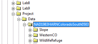
Conventions for File Management
We adopted some simple conventions to manage the complexity of file management for our project. While our conventions remained fairly consistant, the names of some data layers did change between both study areas. All the data uses datum NAD 1983 and uses projection HARN State Plane Colorado South FIPS 0503. The data files for each study area are kept in separate directories within a directory for the projected data. This is shown below:
For each study area, the required files are described below.
| Data Layer | John Martin SWA | Lower Gunnison |
|---|---|---|
| Tamarisk to treat | tamariskClp.shp | TamToTreat.shp |
| Roads | BentRoads.shp | Roads.shp |
| Towns | BentCitiesTowns.shp | Town.shp |
| Water | BentLakes.shp | Lakes.shp |
| Treatment Area | JohnMartinDisolve.shp | TreatmentArea.shp |
| Ownership data | BentCoMap.shp | CoMap.shp |
| County Outline | BentCounty.shp | MeasDeltaCounties.shp |
| Cost-Distance raster | bentcostdist | costdistance |