Introduction
Location Map
Base Map
Database Schema
Conventions
GIS Analyses
Flowchart
GIS Concepts
Results
Conclusion
References
![]()
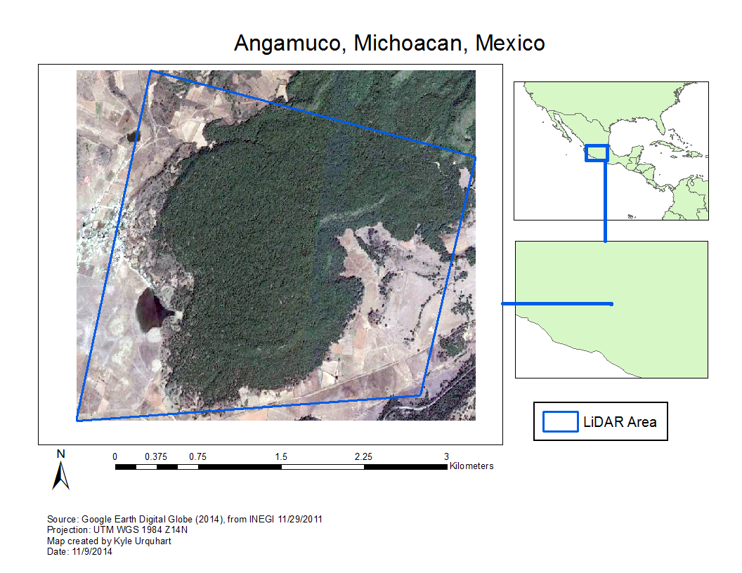
Base Map
Base Map
The LiDAR generated DEM for the site was produced through grants from the National Science Foundation and NASA and may not be reproduced in any public form without prior authorization. Unfortunately, for legal reasons, we are unable to reproduce the map online. Instead, the following map shows the study area as seen in GoogleEarth. In this image the forest canopy is visible, although the LiDAR-generated DEM used in this study shows the surface beneath the canopy. Please contact the author, Kyle Urquhart, or the project director, Dr. Christopher Fisher, if you have any questions.