Introduction
Location Map
Base Map
Database Schema
Conventions
GIS Analyses
Flowchart
GIS Concepts
Results
Conclusion
References
![]()
Results
Results
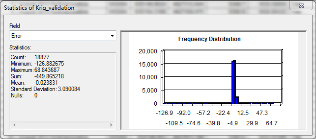
Small Dataset: Toklat River
The table below shows the results from the 1st surface comparison on the August 2nd dataset using the Extract Values to Points tool. From these results it is clear the TIN surface provides a more accurate representation of the point data. This conclusion aligns with the description of how each tool functions. However, for certain datasets it may be more appropriate to utilize the Natural Neighbor tool if a smoothed surface is desirable.
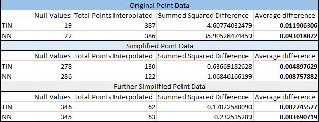
Table 1: Shows results from Value Extraction for the August 2nd dataset.
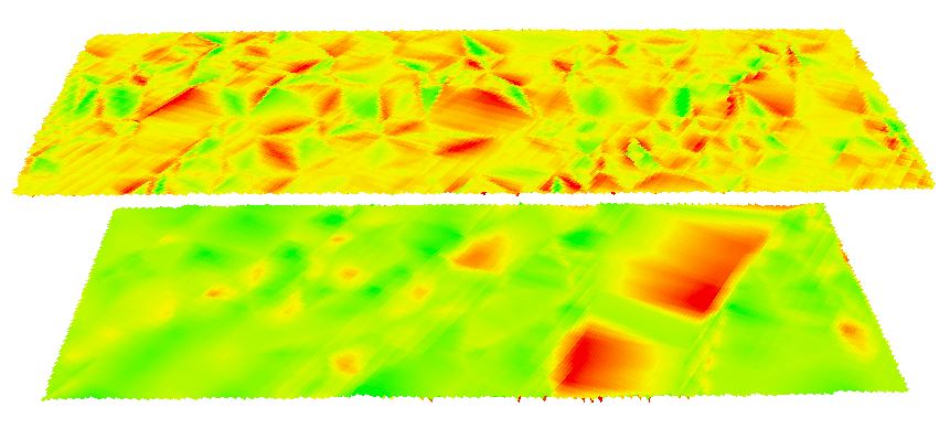
The visual comparison using the Surface Differencing and Raster Calculator tools are again appropriate for different analyses. The surface differencing technique can only be used by TIN surfaces or Terrain datasets, while Raster Calculator can be used only for Raster datasets, clearly. In summary, choose your preferred method based on your available inputs and desired outputs.

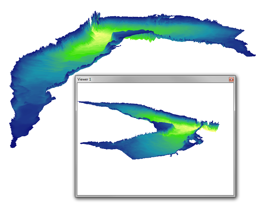
Large dataset: Buffalo Bill Reservoir
The resulting bathymetric map for Buffalo Bill Reservoir is shown below.