ArcGIS Spatial Analysis
Kernal Density Estimation
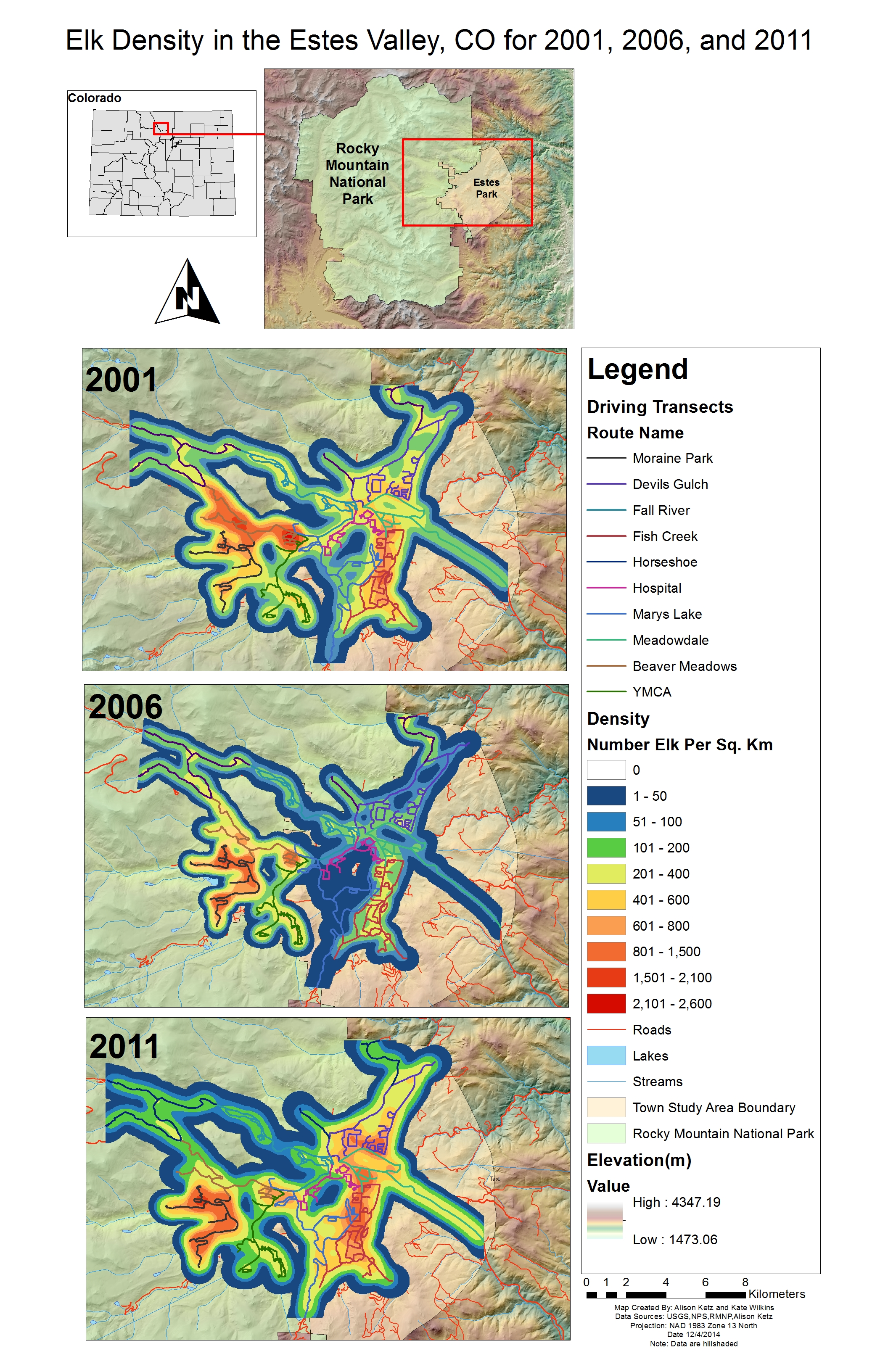
we calculated the kernal density of elk using ArcGIS and the count data (the maximum count across winter) joined with the driving transects for the years 2001,2006, and 2011. The density estimates are clearly linked to the transect routes, although we think the elk are likely to be dispersed across the landscape within the region of the transects. The following maps show a change in the density of elk over time. The animals do appear to be occupying different regions during the different years. We conducted a statistical analysis in R after exporting the data to test this hypothesis.