Introduction
Location Map
Base Map
Database Schema
Conventions
GIS Analyses
Flowchart
GIS Concepts
Results
Conclusion
References
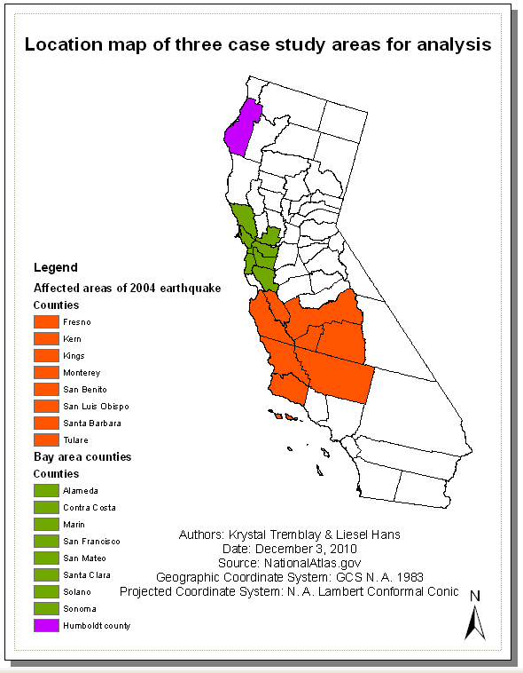
Location Map
Within California, there are three areas we chose as case studies for how earthquake information can be related to risk, damage and hazards. The three areas are Humboldt County, Bay Area Counties and the Central California Counties affected by the 2004 Earthquake.
Last Modified December 7, 2010.