
Introduction
Location Map
Base Map
Database Schema
Conventions
GIS Analyses
Flowchart
GIS Concepts
Results
---Regional
---Site
Conclusion
References
Results
Regional Cost Path A and B
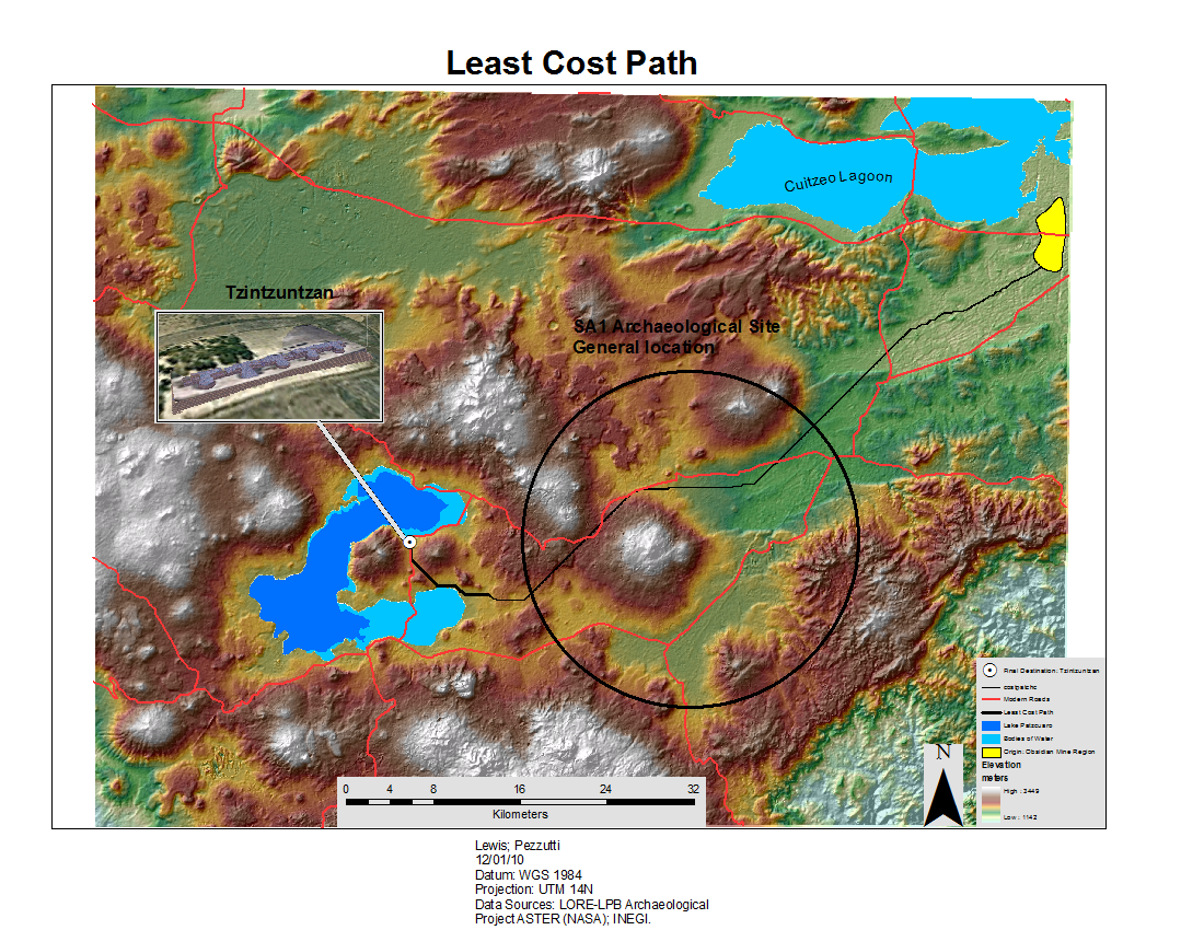
A total of 3 (linked) cost paths going from the northeaster location (obsidan mines) to the western location of Tzintzuntzan were produced. Path were produced at two different scales: a regional and local scale. The regional scale used a 30m resolution grid base map, which produced cost path A and B. Cost Path A is the path from the Obsidian Mine region (Origin) going into SA1 archaeological site. Cost path B travels out of SA1 western boundary into Tzintzuntzan (final destination). The local scale (intra-site) used a 0.5 m resolution cell grid based map which produced cost path C. Cost path C travels within SA1 archaeological site, from the eastern to the western boundary.
Notice: To protect the SA1 archaeological site from vandalism and looting, and to protect the integrity of Mexico's cultural resources, the exacat location of SA1 archaeological site is not given. Instead, a generalized regional location is circled in black.
Once the cost path was stablished, this hypothetical route was analyzed at two different scales. At the regional scale, these cost paths (A, B) were compared to modern roads to see if there was any overalp, potentially suggesting that some of these cost path could represent prehispanic roads that have continued to be used until the present time. At the local scale, path C, was analyzed in relationship to the "pass zone" and the "no pass zone" values of the final friction surface for SA1 archaeological site.
Regional Scale
Cost Path A and B:
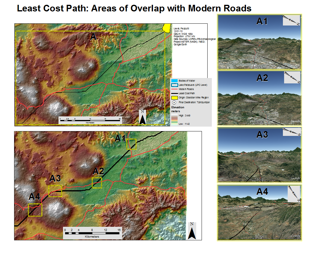
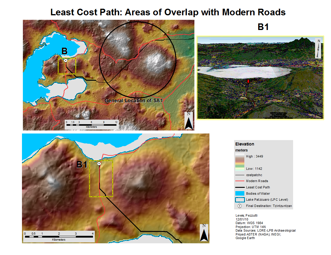
A total of 4 zones were identified as either following modern roads, or crossing modern roads (A1-A4).Overall, this path follows the direction of the modern road (in red on the map) to almost the same orientation. The 4 boxes identifiy the best examples of this argument. The map below demonstrates the location of these overlaps. Box A1 and A2 identify the cost path crossing a modern road, which could potentially suggest a cross road. Box A3 and A4 follow and overlap a modern road. Box B1, for path B, reflects an overlap with a modern road that travels directly to Tzintzuntzan.
Notice: To protect the SA1 archaeological site from vandalism and looting, and to protect the integrity of Mexico's cultural resources, the exacat location of SA1 archaeological site is not given. Instead, a generalized regional location is circled in black.
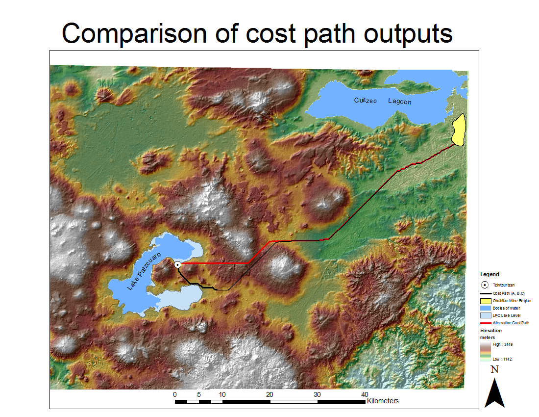
Alternative Route:
An alternative regional scale cost path analysis was done to compare with the orginal output (see maps above). This cost path considered the same origin (obsidian mines) and destination (Tzintzuntzan); however, it did not considered SA1 archaeological site. It only considered the topography of the lake basin region. This analysis produced a slightly different output, where the cost path takes a northern route to its final destination of Tzintzuntzan.
by The JavaScript Source