
Introduction
Location Map
Base Map
Database Schema
Conventions
GIS Analyses
Flowchart
GIS Concepts
Results
---Regional
---Site
Conclusion
References
Introduction
Least Cost Path Analysis: An Archaeological Application in Mesocamerica
David Lewis, Master Student, Fish, Wildlife & Conservation Biology
Florencia Pezzutti, Doctoral Student, GDPE (Anthropology)
Introduction: Prehispanic Roads
For archaeological research, and even in today’s society, trails, roads, and routes are significant because they can define the way people organize and divide their social space. Ancient trails, roads, and routes have been the cultural, economic, and diplomatic veins through which people, exotic goods, traditions, ideas, knowledge, economic trade, and military troops flew dynamically across diverse landscapes (Fournier 2006:27). With the improvement of different technologies and techniques, such as in the field of Remote Sensing, archaeologists interested in documenting ancient prehispanic trails, roads, and routes have used aerial photography, satellite imagery, and archaeological survey.
In some regions of Mesoamerica, as in other European colonized regions of the world, prehispanic roads kept being used during the European colonial period, and have been modified to today’s modern roads. Even though modern development has either altered or completely changed prehispanic roads, there are still regions in Mesoamerica where it is still possible to observe and document intact prehispanic roads in the archaeological record. Such place is the archaeological site of SA 1 in the Lake Patzcuaro Basin, in Michoacán, Mexico.
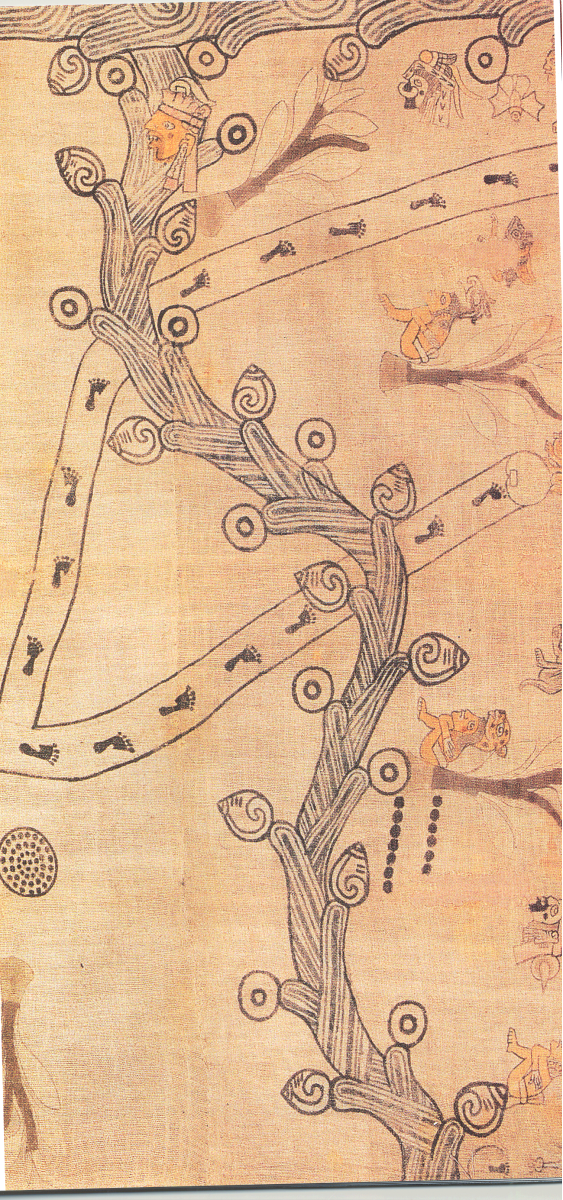
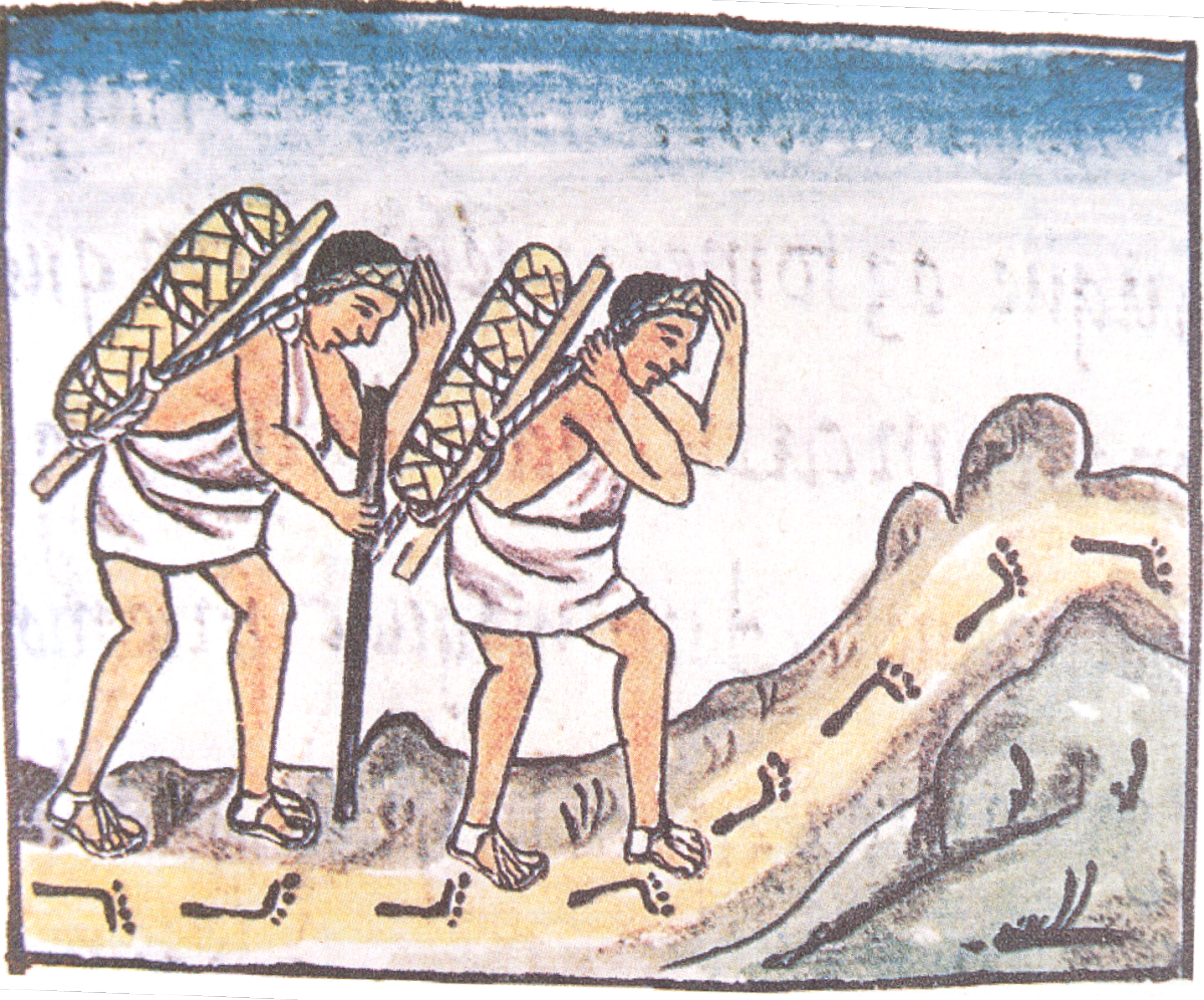
Image information left to right: Tuxpan Canvas. Anthropology Museum, Xalapa, Veracruz , XVI century (Arqueologia Mexicana 2006); Pochteca (maket people) mexicas. Florentine Codex, lib.IX,f.8r (Arqueologia Mexicana 2006)
The Lake Patzcuaro Basin: An introduction
An Archaeological Application of Least Cost Path Analsys: Introduction
This project presents a geographic information system (GIS) based method for the identification of archaeological road, routes, and passages significant for their trade and communication value during the Late Postclassic (A.D.1350-1520) in the Lake Pátzucaro Michoacán, Mexico. The project considers the cost of traveling based on topography. The project methodology utilizes the least-cost path algorithm within GIS framework to obtain the trails, roads, and routes and compared them with recently documented archaeological routes, roads, and passages in SA1 archaeological site, a recently discovered urban late Postclassic site. The path location algorithm considers the cost of slope degree and accumulated cost over a certain distance.
As previous archaeological studies (Morgan 2008) have shown, this project will attempt to show the efficacy of using archaeological features (socio-spatial zones) with terrain modeling (slope) to help reconstruct prehispanic trading and communication routes, roads, and trails in the context of social and ecological factors.
We apply the least cost path analysis, to develop an optimal model which explores the patterns of communication between the eastern obsidian mines regions (periphery) and the west (the core of the Purépecha Empire in the Lake Pátzucaro Basin. The output GIS model can provide the baseline for considering factors that affected the communication at the regional, local, and intra-site scales, but it also presents the potential value of GIS as a cost efficient method to predict routes, roads, and trails in the archaeological record.
Assumptions
- People coming from east to west routes are coming from either the periphery of the Purépecha Empire where the most important obsidian mines are located. These mines are located in the southeastern portion of the Cuitzeo Lagoon,located northeast of the Lake Pátzcuaro Basin. The obsidian mines being considered for this project are: Maravatio and Ucareo/Zinepacuaro. These mines have notoriously distinctive types of obsidian. Obsidian was a desirable commodity among the Purépecha elites. Therefore, the communication routes between the obsidian mine zone and the capital of the Purépecha Empire, Tzintzuntzan, is a significantly important route we explore in this project. These towns were conquered by the Purepecha during the Purepecha Empire expansion and were of great importance due to the obisidan that could be extracted for consumption in the Lake Patzcuaro Basin region.
- People coming from east to west routes are coming to either pay tribute, trade, and or communicate.
- These people travel through already established and familiar roads, which have remained in the archaeological record, but have only been partially mapped and documented. Some of these already established routes have continued to be used and are today’s modern roads in the lake basin region.
- In the context of a mountainous environment, we assume that at high elevations, or with steep slopes the cost of traveling is very high in terms of energy expenditure for traveling on foot.
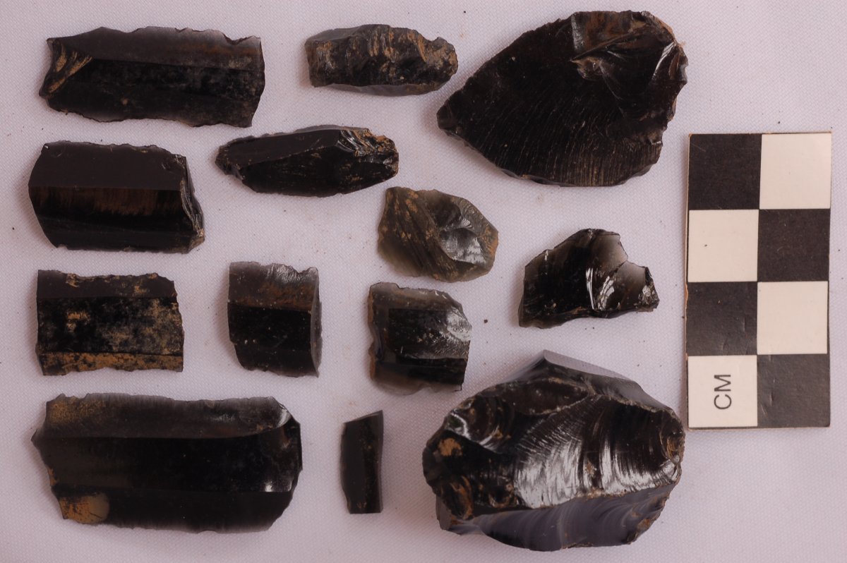
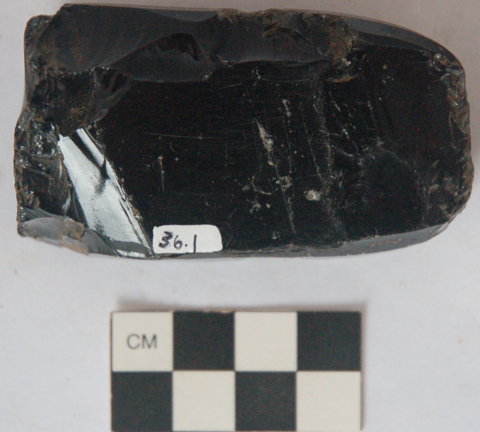
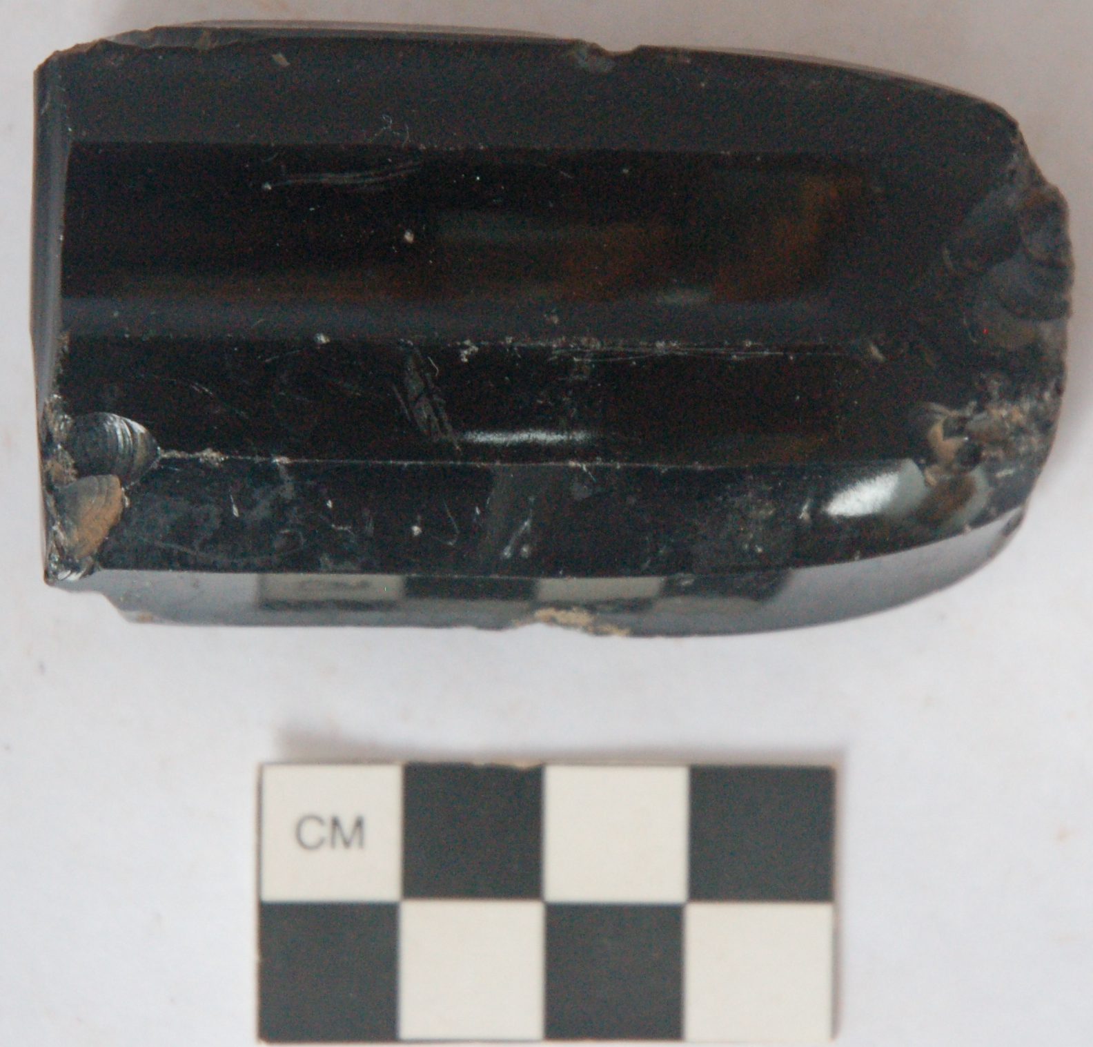
Obisidan tools and debitage collected from SA1 archaeological site (Fisher and LORE-LPB archaeological project)
Back to Top