Introduction
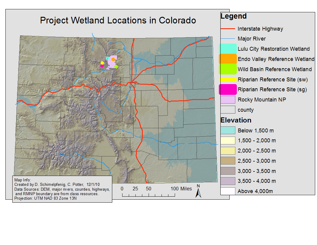
Location Map
Base Map
Database Schema
Conventions
GIS Analyses
Flowchart
GIS Concepts
Results
Conclusion
References
LOCATION
We chose to analyze two reference wetlands in RMNP and two reference riparian wetlands near the park. This allowed us to explore different characteristics in weltand properties based on three geomorphic classes;
Riparian corridor - influenced by the presence of flowing water moving through a channel.
Beaver Complex - concentrated section of dams, with a water table nearer to the
General Wetland - wetland areas with less surface water and a deeper water table.