
Introduction
Location Map
Base Map
Database Schema
Conventions
GIS Analyses
Flowchart
GIS Concepts
Results
Conclusion
References
GIS APPLICATIONS IN WETLAND RESTORATION PLANNING
INTRODUCTION
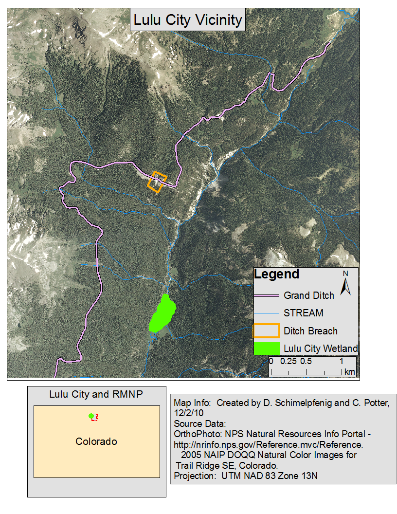
Perched above the headwaters of the Colorado River in Rocky Mountain National Park, CO on the eastern flanks of the Never Summer mountain range sits the Grand Ditch. Built in 1880, the 2 by 6 m earthen channel runs 24 kilometers at approximately 3,200 m above sea level across the continental divide emptying into Long Draw Reservoir. Owned and operated by the Water Storage and Supply Company, the Grand Ditch intercepts approximately 50% of the water tributary the Colorado River headwaters, supplying the Front Range with nearly 20 million cubic m of water per annum (Woods 2000).
In 2003 the Grand Ditch breached in a reach above Lulu Creek, inundating the creek, several km of the Colorado River and its floodplains, and the Lulu City wetland with more than 45,000 cubic m of sediment and debris (RMNP Fact Sheet 2010). Historical air photo analysis and pit excavation soil stratigraphy interpretations revealed several previous debris flow events prior to the 2003 breach. Sediment from these debris flows has increased the elevation of the Lulu City wetland, and resulted in a lowered water table in some areas (Potter 2010 unpublished).
The purpose of this project is to design a restoration protocol for the headwaters of the Colorado River. Using field collected data from both disturbed and reference sites as well as geomorphic wetland classifications derived from ortho imagery, statistical and GIS analyses, and literature review; we intend to construct several possible models for restoration of the degraded riparian corridor and wetlands adjacent to the Colorado River based on the spatial attributes of reference wetlands.
Website Created by D. Schimelpfenig and C. Potter - 12/6/10