Introduction
Location Map
Base Map
Database Schema
Conventions
GIS Analyses
Flowchart
GIS Concepts
Results
Conclusion
References
Using GIS
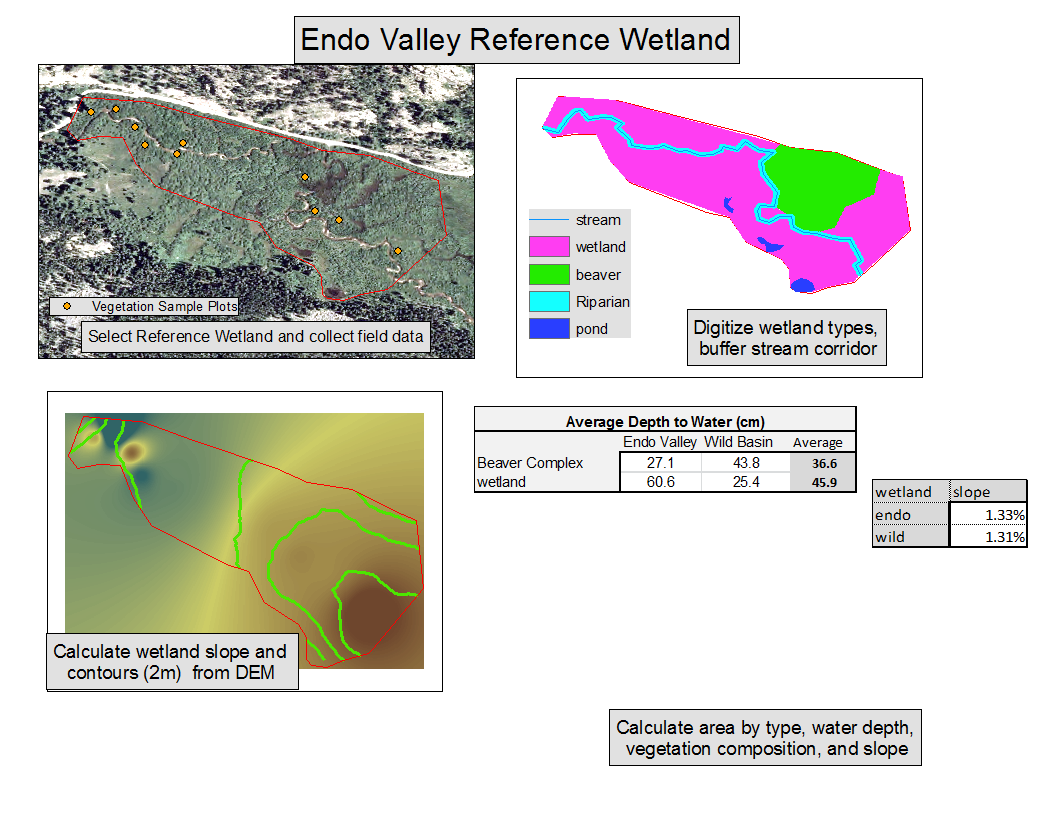
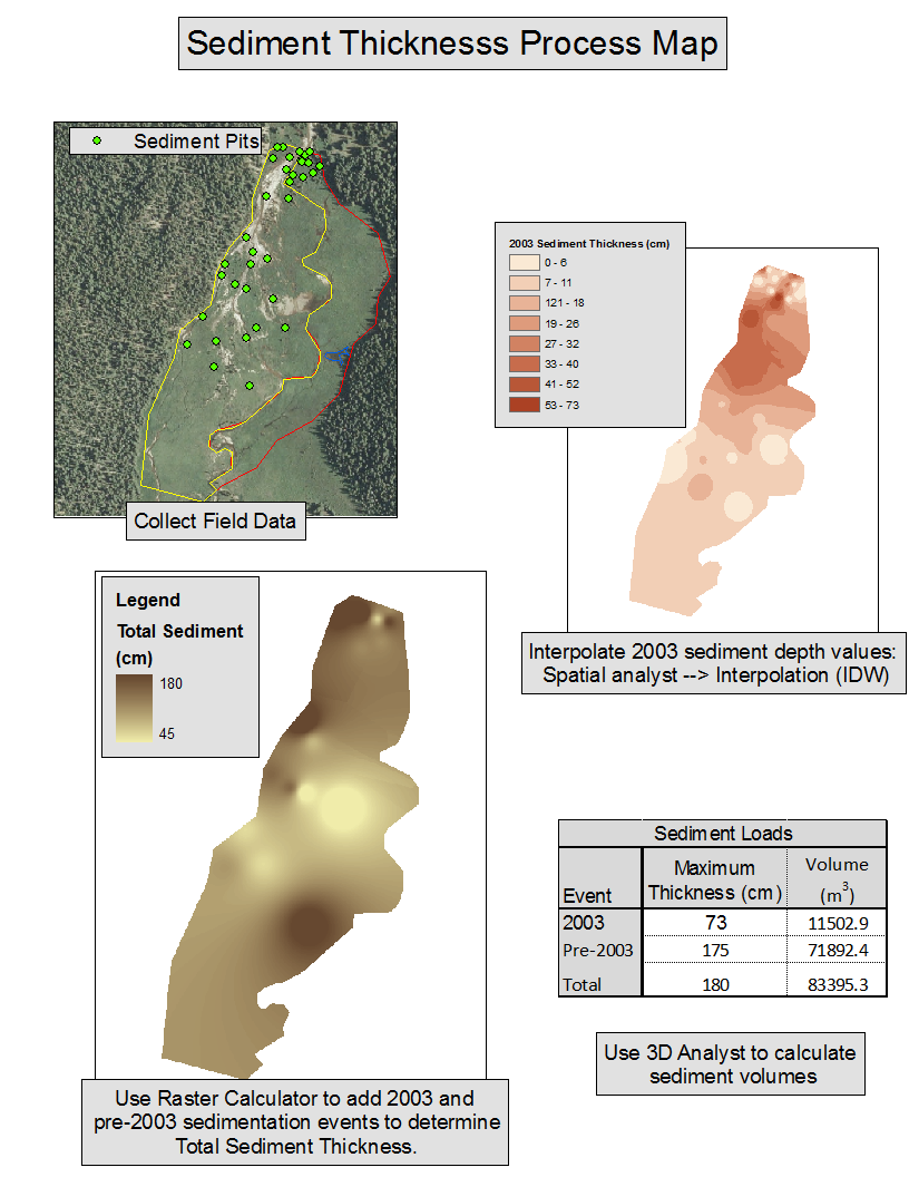
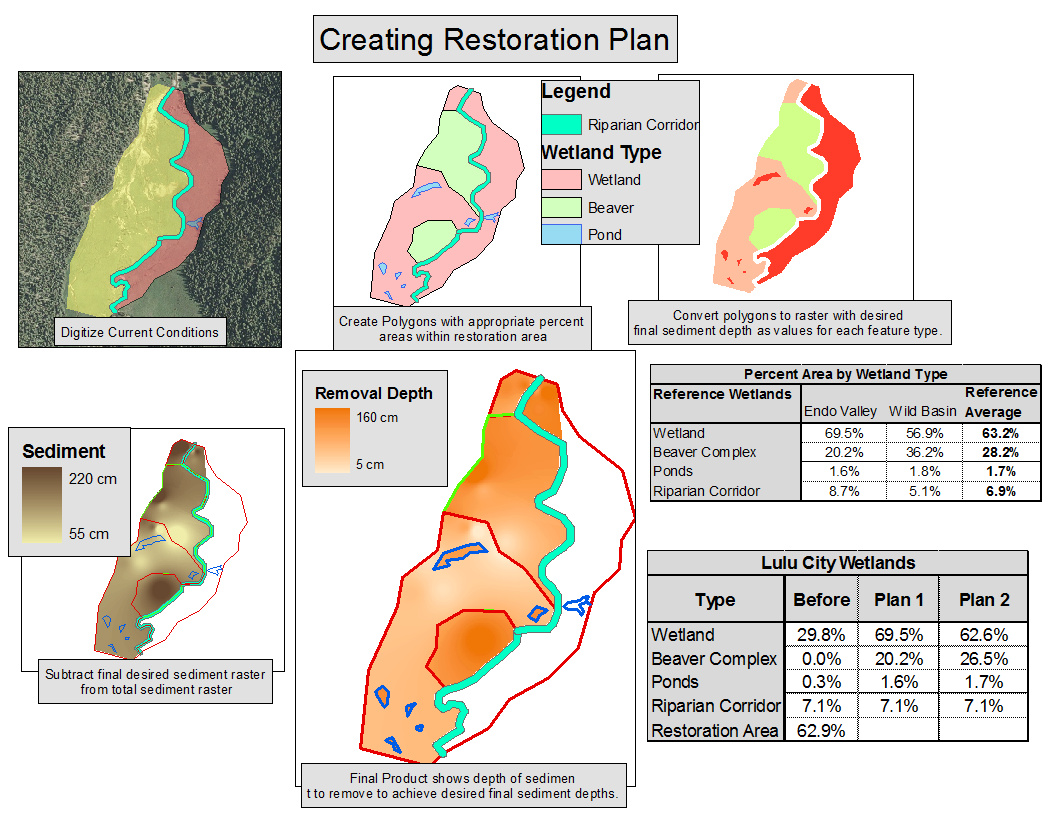
This project used GIS analysis techniques in multiple ways. First, in determining the scale of disturbance within Lulu City Wetland we used Inverse Distance Weighted interpolation of sediment thickness data collected in the field. Second, we approximated the distribution of wetland types within reference wetlands by remotely sensed determination of primary biogeomorphic influence. This step categorized reference wetland into a general zone, beaver complex, riparian corridor, and pond. We found depth to water characteristics and community composition for these wetland categories through non spatial analysis. Our data sources did not allow us to use spatial analysis for these wetland properties. Finally, combining the results from steps one and two, we created two potential plans which would result in Lulu City Wetland having similar properties to our reference wetlands following restoration. We were not only able to show how different wetland features might be arranged within the wetland, but how much sediment would be needed to remove from each area to achieve these goals. Other GIS analysis techniques used in this process are slope calculations and buffering sreams to create riparian corridors.
The three general steps described above are shown in the figures below.