Introduction
Location Map
Base Map
Database Schema
Conventions
GIS Analyses
Flowchart
GIS Concepts
Results
Conclusion
References
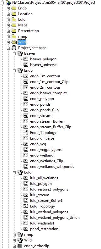
Database Schema
Snapshots of our database layout. We organized datasets, rasters, and shapefiles separately for each site. Each location was housed in a different master folder. All maps were housed in a master maps folder.
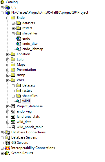
We started organizing in a personal geodatabase within Arc Catalog, but found it to be less convenient because raster files were stored outside of each wetland's feature dataset directory. In creating our own database layout we had to pay careful attention to standardized projection and datum