Introduction
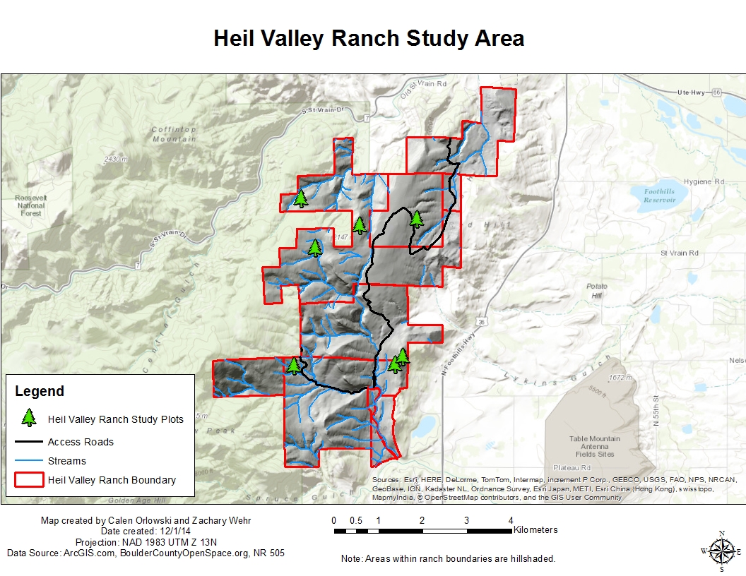
Location Map
Base Map
Database Schema
Conventions
GIS Analyses
Flowchart
GIS Concepts
Results
Conclusion
References
![]()
Base Map
Base Maps
Our overall study area is comprised of both the Hall & Heil Valley Ranches located within Boulder County, Colorado.
- The areas are located on two Boulder County Parks and Open Space properties, Hall Ranch and Heil Valley Ranch, which were acquired by Boulder County in 1993 and 1994.
- Prior to county acquisition, each of the properties operated as Ranches which subsistited by grazing, logging, and mining.
- The Front Range of Colorado was settled during and shortly after the 1859 Gold Rush which occured throughout the Northern Front Range. European settlement brought widespread grazing, timber harvesting, and mining to the area.
- Prior to European settlement, the Front Range was the home of the Ute Native Americans.
- Within each of the Ranch properties, there were seven study sites selected, creating 14 total study sites between both properties. Heil and Hall Ranches occur within the lower Montane forest-cover type with a predominant overstory of Ponderosa Pine (Pinus ponderosa). Both ranches combined have a total of over 8,000 acres
- Both properties experience high recreation-use (hiking, biking, horse-back riding, running, wildife viewing, etc) throughout the year due to their proximities to Denver, Boulder, Longmont, and Lyons.
- Boulder County currently manages each of the properties with the goal, "To conserve natural, cultural and agricultural resources and provide public uses that reflect sound resource management and community values."

Hall Ranch is just over 3,000 acres in size with an elevation range of 5,500-6,800'.

Heil Valley Ranch is 5,020 acres in size with an elevation range of 5,400 - 6,800'.