Introduction
Location Map
Base Map
Database Schema
Conventions
GIS Analyses
Flowchart
GIS Concepts
Results
Conclusion
References
Base Map
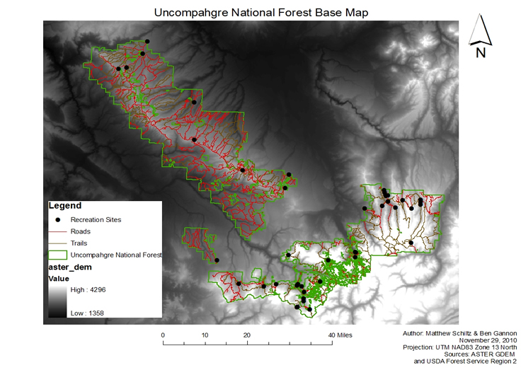
Included in the base map are data layers common to both analysis methods. The UNF boundary, recreation sites, roads, and trails all come from Grand Mesa, Uncompahgre, and Gunnison National Forests Geospatial Services. The ASTER digital elevation model (DEM) comes from the Earth Remote Sensing Data Analysis Center and has a native spatial resolution of ~ 25x25 meters.