Introduction
Location Map
Base Map
Database Schema
Conventions
GIS Analyses
Flowchart
GIS Concepts
Results
Conclusion
References
Using GIS to Determine Native Felid Habitat in Urbanizing Areas and its Link to Human and Domestic Cat Conflicts
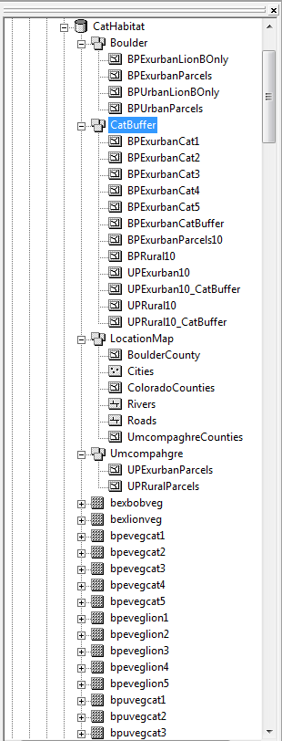
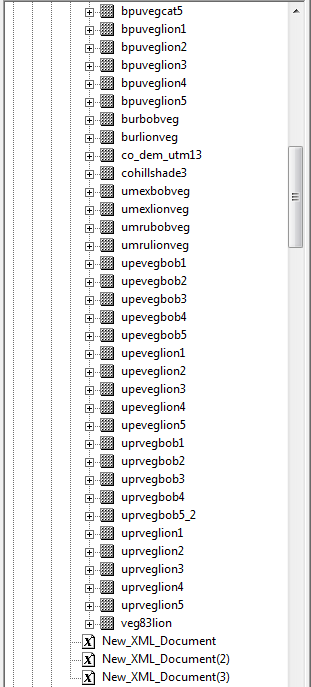
Database Schema
We created a geodatabase to organize our vector and raster files. We created 4 feature datasets, each containing feature classes, and a number of raster files. This made for easy organization of our files. Below is an image of our geodatabase