Introduction
Location Map
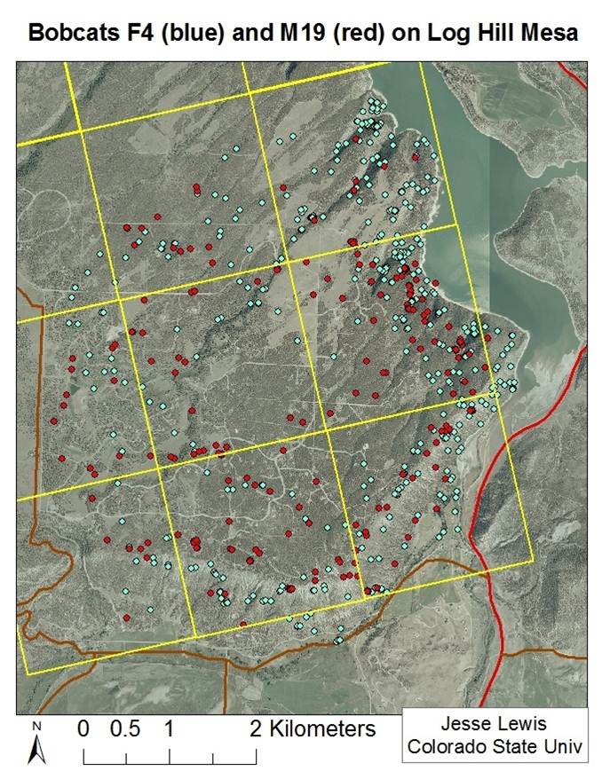
Base Map
Database Schema
Conventions
GIS Analyses
Flowchart
GIS Concepts
Results
Conclusion
References
Using GIS to Determine Native Felid Habitat in Urbanizing Areas and its Link to Human and Domestic Cat Conflicts
Conclusions
Question 1: What are the differences in suitable bobcat and mountain lion habitat surrounding parcels in different levels of urbanization?
It is interesting that the UP exurban area had the lowest percentage of suitable bobcat oover the four levels of urbanization. We would expect that Boulder urban would have the lowest suitable bobcat habitat due to its proximity to humans. Perhaps this isn't the case due to the juxtaposition of Boulder's urban center with natural habitat and the generalist nature of bobcats.
Question 2: What are the differences in potential domestic cat-wild felid interaction as determined by suitable habitat and how do these risks compare with human perceptions?
It is also interesting that the UP exurban areas had some of the lowest percentages of suitable habitat within domestic cat buffers when we would expect Boulder urban to have the lowest percentages. However, it makes sense that there is no suitable mountain lion habitat within Boulder urban domestic cat home ranges, due to the small parcel sizes and the proximity to people.
Using GIS to Determine Native Felid Habitat in Urbanizing Areas and its Link to Human and Domestic Cat Conflicts
As expected, Boulder exurban residents, the area with the highest percent of suitable bobcat and mountain lion habitat within domestic cat home range buffers, expressed the highest risk perceptions regarding domestic cat-wild felid interaction as shown in the elicitation surveys. The urban Boulder residents had the second highest number of risk perceptions, however there was very little potential interaction risk (as measured by habitat suitability within domestic cat buffers). Additionally, residents within the rural UP study area expressed the fewest risk perceptions when we calculated a high potential for interactions between wild felids and domestic cats. Due to the disconnect between interaction risk and risk perceptions in the Boulder urban and UP rural areas, human dimensions specialists might consider targeting these regions for risk mitigation education programs.
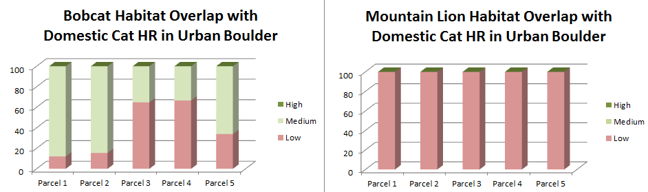
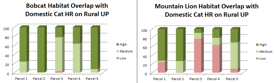
Additionally, we calculated percent bobcat and mountain lion habitat for 5 individual parcels from each level of urbanization. To illustrate this analysis in two of the study areas (Boulder urban and UP rural) we've included graphs below. In the coming months, mail surveys aimed at measuring resident's risk perceptions associated with domestic cat-wild felid interaction will be sent to the parcels in this study. This risk perception data can be linked to percent suitable wild felid habitat within domestic cat buffers by individual parcels so that wildlife managers can have fine scale data to create risk mitigation education programs targeted at specific neighborhoods which has been shown the increase behavior change and education program efficiency and effectiveness.
Following are the potential mail survey questions that can be linked with the parcel level habitat suitability data:
Potential Mail Survey Questions
1.How often have you observed outdoor cats in your neighborhood:
-Threatened by bobcats, mountain lions
-Attacked by bobcats, mountain lions
-Killed by bobcats, mountain lions
Future Research and Caveats
To get a better proxy of domestic cat-wild felid interaction risk, we should incorporate mountain lions, bobcats, and domestic cat movement into risk models. In both the Uncompaghre Plateau and Boulder study areas, these three felid species with be tracked concurrently by researchers at Colorado State University and the Colorado Division of Wildlife.
Additionally, researchers should add in prey availability, road density, human density, and other factors known to be important to wild felid survival into habitat suitability models.
Habitat suitability should also be determined per parcel to truly understand human and domestic cat interactions with wild felids on a small scale.
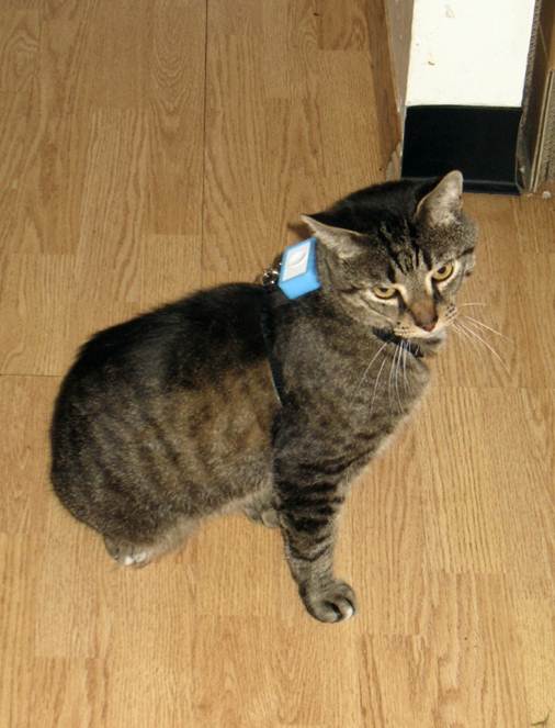
Picture of Kink the Cat with GPS Unit and Movement of Bobcats on the Uncompahgre Plateau ..........