
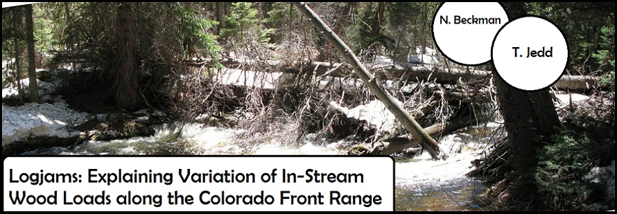
Introduction
Location Map
Base Map
Database Schema
Conventions
GIS Analyses
Flowchart
GIS Concepts
Results
Conclusion
References
File Naming Conventions
"Logjams” Personal Geodatabase (ArcGIS 9.3.1)
dem_clip_83 is a mosaicked file created from USGS 30m x 30m resolution digital elevation model.
Costpat_ben: the result of the cost-path analysis conducted for road-based travel from municipal boundaries to field site locations.
NNstats7x7: the resulting raster of the cluster analysis (Nearest Neighbor statistics).
rd_density2km is the raster file generated in the road density analysis.
Front Range (Feature dataset)
Admin_type_Theo_clip shows jurisdictional boundaries for National Forest, National Park, and Colorado State Park. Data provided by COMap Project, Colorado State University, Theobald et. al.
AllroadsCDOT_clip contains line layers for roads within our study site boundaries, data provided by
Colorado Department of Transportation (CDOT)
CDOTmuni_merge_Clip contains polygons for metropolitan centers within an extended boundary, data provided by Colorado Department of Transportation
CDOTmuniboundaries contains polygons for municipal areas within the Colorado Front Range.
cityclipNB represents municipal boundaries within the larger municlip extent, the extended study area boundary we created.
diversions contains points for locations of dams and diversion projects within study site boundaries, data provided by CDSS: Colorado Decision Support Systems
extendedstudyarea_muni is an extension of the study area boundaries used for creating road layer and municipal boudary clips.
fieldsites is a shapefile that contains bounded rectangular polygons around the reaches surveyed.
Lakes_clip shows polygons for bodies of water, data provided by CDOT
Protection_mech_Theo_clip contains information on management practices within subunits of federal and state lands. Data provided by COMap Project, Colorado State University, Theobald et. al.
reservoirs contains polygons depicting reservoir projects within study site boundaries, data provided by CDSS: Colorado Decision Support Systems
romofirehistory_sibold contains polygons depicting date of last major burn for forest stands within Rocky Mountain National Park. Provided by RMNP GIS Coordinator, compiled from Sibold et al fire history data.
Stream_class_clip is a streams layer based on a digital elevation model of the study area. Created by Nick Sutfin.
Stream_class_clip_Buffer is created from Stream_class_clip with a buffer of 150 m.
Study_area is a polygon we created using the bounding coordinates of the study area.
Field_Data (Feature Dataset)
km_reaches depicts field site boundaries along stream reaches
Wohl_jams_ROMO depicts point locations for channel-spanning jams, data collected by Ellen Wohl
WP_2010_CSJnb depicts point locations for channel-spanning jams, data collected by Natalie Beckman
WP_2010_DS depicts point locations for end (downstream) of 1-km stream reaches
WP_2010_US depicts point locations for end (downstream) of 1-km stream reaches
Results (Feature Dataset)
Reaches_admintype is a file created to union attributes from land ownsership type to our reaches shapefile.
Reaches_protmech_intersect also depicts reaches with an added attribute field-- the protection mechanism, or land management protocol in place on a given public land.
Stream_slope_clip is a polyline shapefile that contains information on stream class and associated slope.
----------------------------------------------------------------
All data are projected using the following parameters: