
Introduction
Location Map
Base Map
Database Schema
Conventions
GIS Analyses
Flowchart
GIS Concepts
Results
Conclusion
References
Conclusions and Further Research
Out most conclusive finding is that the cluster analysis (Nearest Neighbor, or Neighborhood Statistics) reveals higher density of jams within the National Park setting. The Forest Service and State Park lands displayed a lower clustering value than in the National Park. This suggests—though it is not conclusive at this point—that Nationa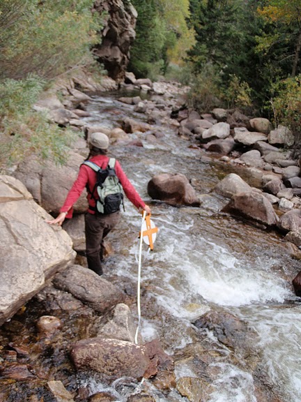 l Park lands are more conducive to natural logjam accumulation. Management practices can vary across administrative type, and “wilderness” designation does exist in both National Park lands sampled and National Forest. However, the field site areas within the National Park setting tended to fall within or along Wilderness boundaries. Outside of the park, only one other field site was along a Wilderness boundary (Joe Wright Creek in Arapahoe-Roosevelt National Forest, along the Neota Wilderness boundary). All of this suggests that logjam formation is more likely in land management areas that designate wilderness areas.
Obtaining field data for the project was arduous and time-consuming. For some of the reaches, two surveys were conducted. In these cases, some of the jam locations did not match up. This could have been due to conflicting notions of what a jam is, where to record its location, or a simple mis-reading of the GPS unit. In addition, the jam locations often did not fall cleanly along the stream layer generated from the digital elevation model (DEM). For this reason, our field sites needed to be defined with a 150-m buffer on either side of the stream. In future field work, it will be important to clarify methods used to collect information on logjams.
Another problem that we faced was computing difficulty given the complexity of our roads layer. For this reason, we needed to clip certain types of roads (local and connector) to smaller bounded areas within our larger “study area” polygon. We were able to clip the highways and forest roads, however, to a larger polygon than our study area (an area we called “municlip”). In sum, the large volume of roads data coverage for the Front Range region, had to be condensed by leaving out some routes for the sake of improving computation speed. Some of the road density layers took hours to create—if they were able to be generated at all!
We look forward to continuing further work on this project for the Colorado Conference on Earth System Governance in May 2011 at Colorado State University. Thanks for looking at our project webpage! If you have questions, please contact N. Beckman (Beckman1 [at] warnercnr.colostate.edu) or T. Jedd (theresa.jedd [at] colostate.edu).