
Introduction
Location Map
Base Map
Database Schema
Conventions
GIS Data
GIS Processes
Flowchart
Results
Conclusion
References
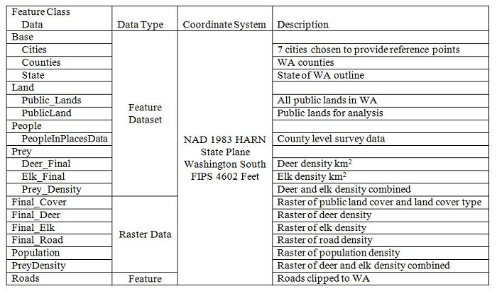
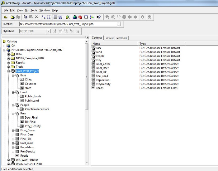
Database Schema
| GIS analyses of original datasets result in a massive amount of files that can quickly become unmanageable if a clear system is not used from the outset. A schema defines the physical structure of the data files; below is the schema used to organize the data for this project. Although we began with a clear vision of what we wanted to do, we had little prior experience regarding exactly how to get it done. Therefore, there was a lot of redudancy, reprocessing, and restructuring of the project as we went through our steps. For the most part we gave our files descriptive names as we went through our processes, but only our final files were included in the geodatabase. Some unique descriptors (outlined below) were used for these files. | |
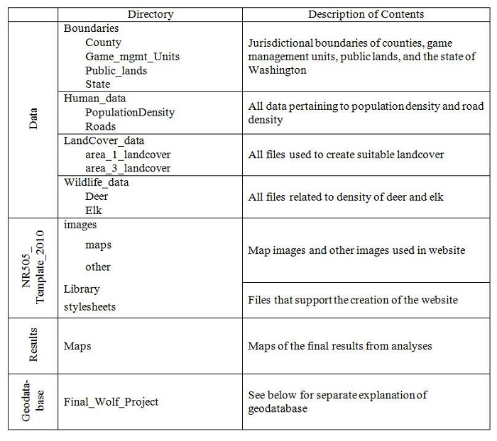 | |
We chose to use a geodatabase for our projects so that all the pertinent files were in one central location; however, the geodatabase holds most of our final files rather than every file used along the way. | |
 | |
 |