
Introduction
Location Map
Base Map
Database Schema
Conventions
GIS Data
GIS Processes
Flowchart
Results
Conclusion
References
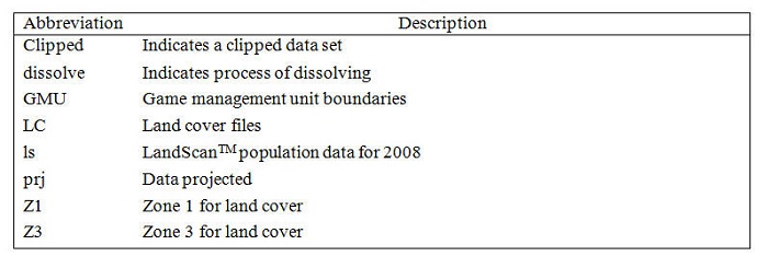
Conventions
| Naming conventions help to ensure that anyone conducing a GIS analysis remembers their steps and continues to use the correct files or can follow the same steps in future processes. Conventions can further reduce controllable propogation of error (and high levels of stress). For the most part, we gave our file very descriptive names. However, we would have benefited from having a more organized naming convention from the outset of the project that was consistent across our three project collaborators. Some unique descriptors used for files in our project are listed below. |
|
| |