Introduction
Location Map
Base Map
Database Schema
Conventions
GIS Analyses
Flowchart
GIS Concepts
Results
Conclusion
References
Emerging from the Pacific Ocean floor over 2,000 miles from the nearest continent, the Hawaiian Archipelago is the most isolated island chain in the world. The combination of time and distance has lead to a remarkable assemblage of organisms that have dispersed by chance and radiated into unique species to fill each ecological niche available. The islands are perhaps best known for the diverse and strikingly beautiful collection of bird species. However, Hawaii is also known dubiously as “the extinction capital of the world.”
Prior to human arrival in the Hawaiian Islands, there were at least 113 bird species, the Hawaiian Islands had already lost at least 48 species prior to the arrival of Europeans in 1778, and have lost at least 23 more since (Olson and James, 1991).
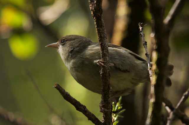
Until as recently and the mid 1970’s, researchers found that the island of Kauai still contained all but one of the species known since the arrival of Europeans (Conant et al., 1998). Since then it is likely that at four more species have gone extinct. Kauai is still home to eight extant species of forest bird.
Six of these species are single-island endemics, meaning their distribution is limited solely to the Island of Kauai. The combined pressure of anthropogenic habitat loss, predation from introduced rats and introduced avian disease are the major causes of decline in forest birds (Scott et al., 1986). These threats have been compounded by two major hurricanes, Iwa in 1982 and Iniki in 1992, as well as by the looming threat of climate change.
Currently all native forest bird species on Kauai are restricted to the relatively remote reaches of montane wet forest of the Alakai Plateau.
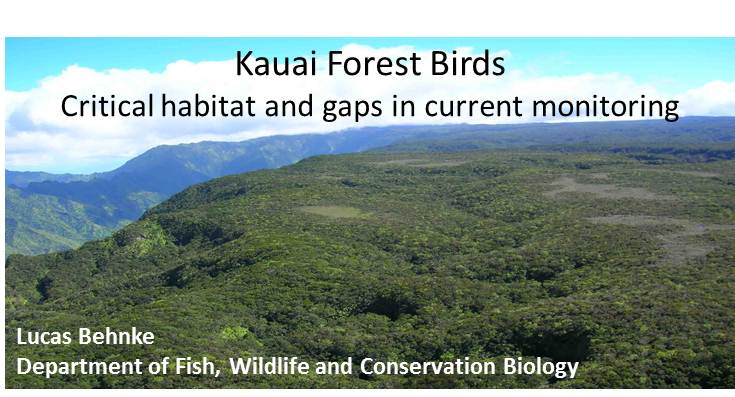
The goal of this research is to determine critical habitat for the remaining populations of forest birds and to identify potentially un-surveyed areas of suitable habitat that should be considered when searching for rare and endangered species. The study site is located on the Alakai Plateau, which is comprised predominantly of State of Hawaii property within the Alakai Wilderness Preserve and parts of the Kokee State Park and Na Pali Kona Forest Reserve.
The study area follows a general gradient of decreasing elevation and precipitation from east to west. The Plateau is bound to the east by the highest point on the island, Mt. Kawaikini (~1600 m) along the ridge that forms the eastern boundary and the Kokee area in the west where the elevation drops to just over 1000m before steeply dropping to the Na Pali Coast. The forest proceeds from wet montane forest dominated by ohi’a lehua (Metrosideros polymorpha) in the east, receiving ~900 cm of rain per year, to the relatively mesic mixed ohi’a-koa (Acacia Koa) in the west with a rainfall of 190 cm per year (USGS, 2009).